


Curcy sur orne 1 @

yannick-p
User
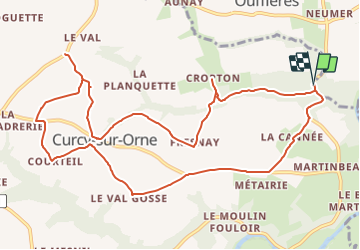

Length
12 km

Max alt
213 m

Uphill gradient
234 m
Km-Effort
15.2 km

Min alt
50 m

Downhill gradient
235 m
Boucle
Yes
Creation date :
2021-08-02 20:06:34.16
Updated on :
2021-08-02 20:34:45.158
3h00
Difficulty : Medium

FREE GPS app for hiking
 SityTrail
IGN / Geographical institutes
SityTrail Plus
The world is yours!
About
Trail Geocaching of 12 km to be discovered at Normandy, Calvados, Le Hom. This trail is proposed by yannick-p.
Positioning
Country:
France
Region :
Normandy
Department/Province :
Calvados
Municipality :
Le Hom
Location:
Curcy-sur-Orne
Start:(Dec)
Start:(UTM)
684108 ; 5432161 (30U) N.
Comments